The Keeper network divides the surface world into four terrain classifications, established over two centuries of post-Lockdown documentation. The system was not designed. It emerged from the accumulated language of surveyors who needed to agree on what they were looking at before they could report it accurately.
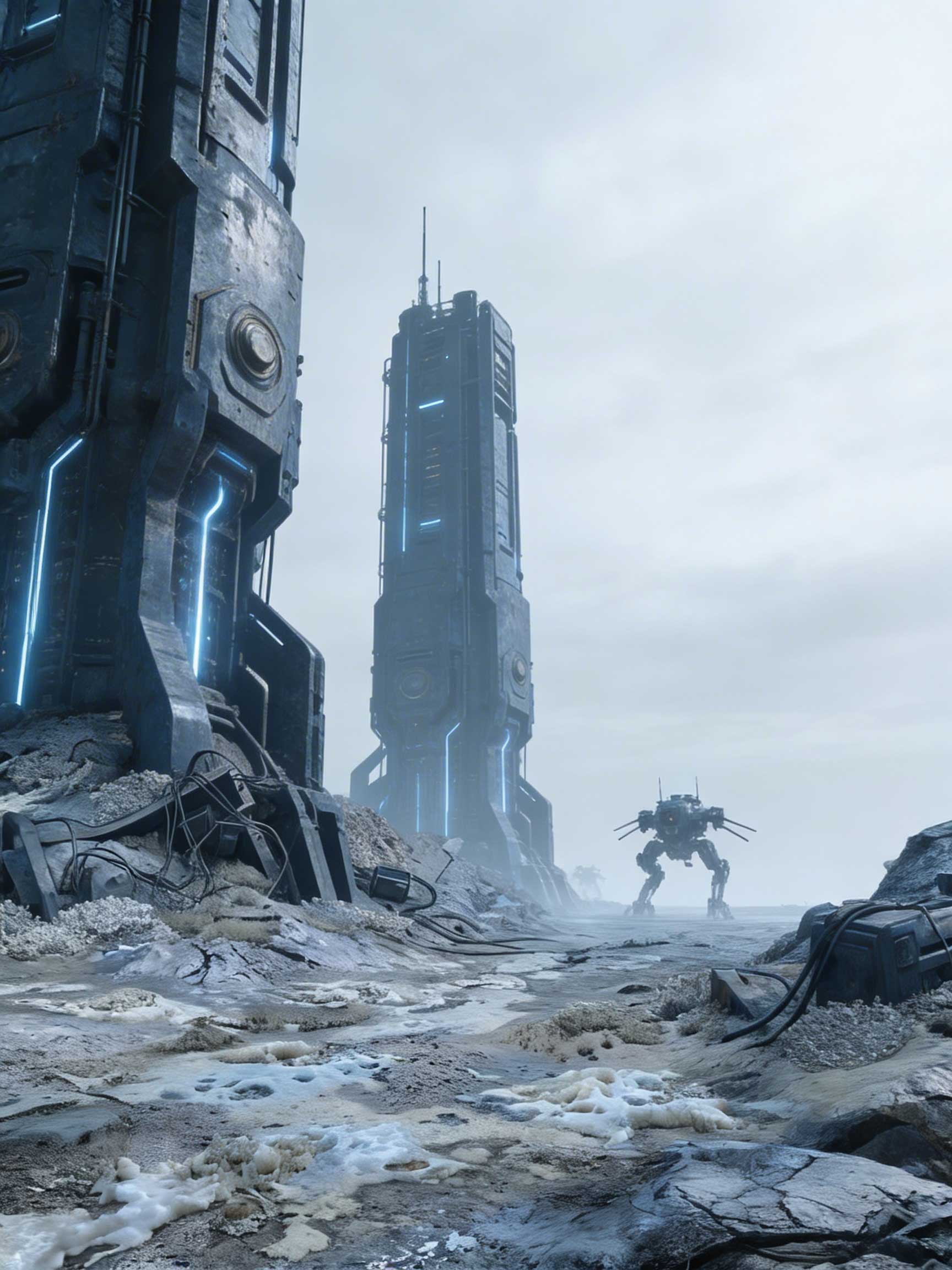
Class I — Stabilization Domains. Regions under active Vault node management. Geologically locked. The stillness here is not natural — it is imposed. Hunter mecha patrol the perimeter. Keepers are advised to document from beyond sensor range and not to linger. The network is failing, but slowly, and the failing nodes are the most unpredictable.
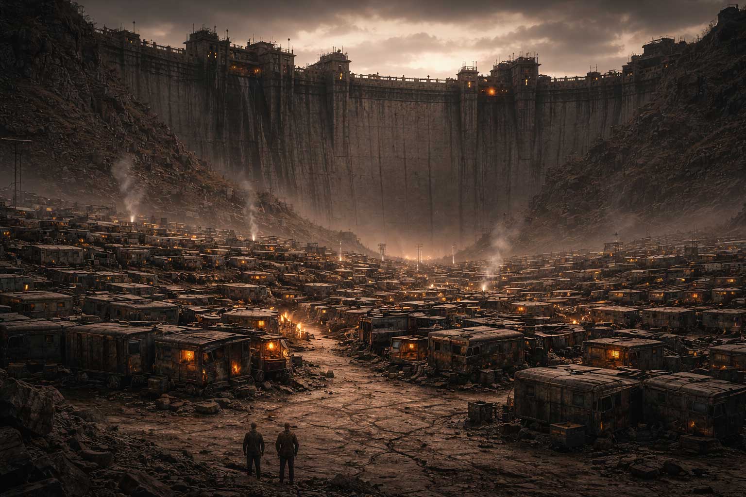
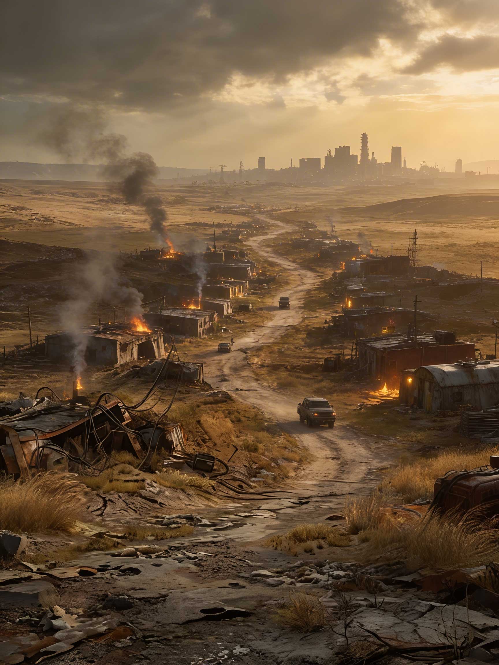
Class II — Transition Belts. The primary human survival band. Settlement clusters, convoy corridors, trade routes. Ground that holds without Vault support — for now. The eastern Eurasian corridor is the widest surviving belt. This is where most of the documented world lives.
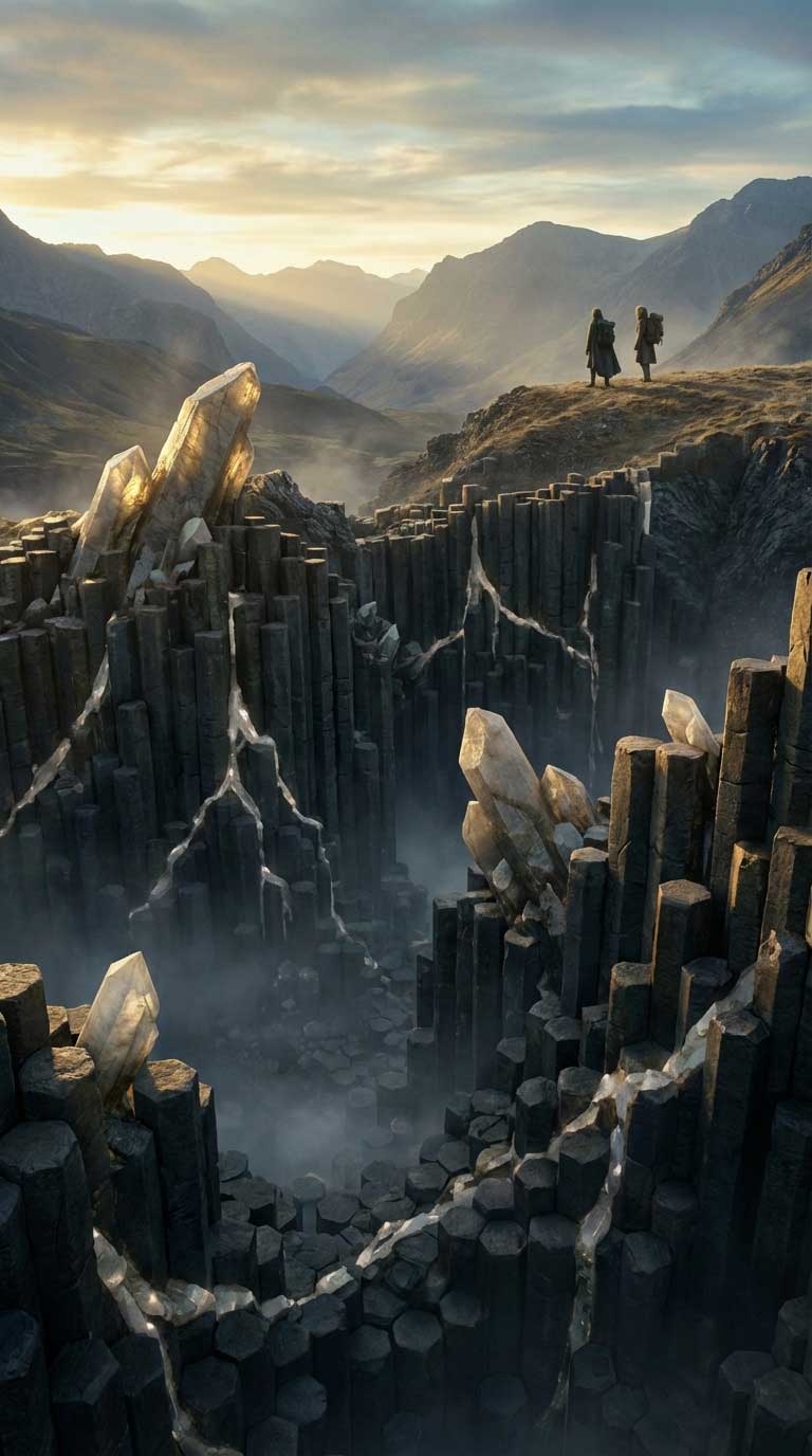
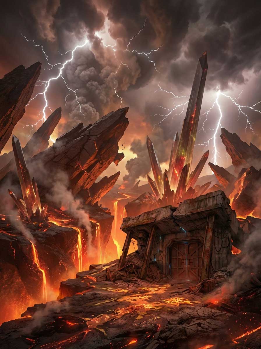
Class III — Hyper-Dynamic Zones. Active geological release regions. Pressure accumulated across two centuries of Vault containment escaping along uncontrolled boundaries. Crystal formations. Fissure events. Atmospheric discharge. These zones are expanding. Keepers do not enter without specific purpose and a confirmed exit route.
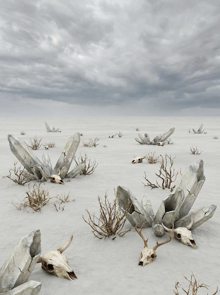
Class IV — Dead Basins. What a Hyper-Dynamic Zone becomes when the energy is spent. Sterile. Flat. Absolute. The mineral crust that forms after a full release event preserves the surface geometry of what came before it. Surveyors have noted the shapes. This record does not speculate on what that means.